Planning a California road trip and wondering how far Lake Tahoe is from Yosemite National Park? The shortest driving distance is around 180 miles, taking approximately 4 to 6 hours depending on the route and seasonal road conditions. While the direct line distance between the two is about 150 miles, the Sierra Nevada landscape means your road trip options vary. If you're curious about alternate Yosemite connections like how far Yosemite is from Los Angeles, or want to know how many days you need in Yosemite, we have you covered. You’ll also want to consider driving through Yosemite and trail accessibility, especially across seasons.
Direct Distance Between Lake Tahoe and Yosemite National Park
The direct distance between Lake Tahoe and Yosemite National Park is approximately 150 miles (240 kilometers) as the crow flies. However, due to the mountainous terrain of the Sierra Nevada and the lack of a straight-through road, the actual driving distance is longer and varies depending on the route and entrance into Yosemite.
Driving Distance and Estimated Travel Time
The shortest driving routes between South Lake Tahoe and Yosemite Valley range from approximately 180 to 215 miles (290 to 345 kilometers). Travel time typically takes around 4 to 5.5 hours, depending on the route selected, traffic conditions, and seasonal road closures.
Keep in mind that Yosemite National Park has several entrances, and your chosen route may lead you to different areas of the park. The most common entrances when traveling from Lake Tahoe are the Tioga Pass Entrance (via Highway 120 East), the Big Oak Flat Entrance (via Highway 120 West), and the Arch Rock Entrance (via Highway 140).
Main Route Options
Tioga Pass Route (Highway 395 & Highway 120 East)
- Driving Distance: Approx. 180 miles
- Estimated Drive Time: 4 to 4.5 hours
- Seasonal Access: This is the most direct and scenic route but is only open in summer and early fall due to snow closures. Tioga Pass (elevation 9,945 feet) typically opens between late May and early July and closes by November.
This route takes you south on US-395 along the eastern Sierra, with stunning views and possible stops like Mono Lake, before turning west onto Highway 120 to enter Yosemite via Tioga Pass. This route provides access to Tuolumne Meadows and high-country hikes.
CA-88 & CA-120 Northern Route (Year-Round Option)
- Driving Distance: Approx. 200–215 miles
- Estimated Drive Time: 5 to 5.5 hours
- Seasonal Access: Available year-round, making it ideal during winter or early spring when Tioga Pass is closed.
This route involves traveling west from South Lake Tahoe via CA-88 (Carson Pass Highway), then south through the Central Valley to connect with CA-120 West toward the Big Oak Flat Entrance. While less scenic than Tioga Pass, it offers reliability in all seasons and passes through charming Gold Country towns like Jackson and Sonora.
Highway 50 to CA-49 to Highway 140 (Arch Rock Entrance)
- Driving Distance: Approx. 210 miles
- Estimated Drive Time: 5 to 5.5 hours
- Seasonal Access: Open year-round, but prone to winter driving conditions and occasional delays due to rockslides or road work.
This route begins on Highway 50 west from Lake Tahoe, then heads south on CA-49 — known as the Golden Chain Highway — through historic towns like Placerville and Mariposa, ultimately reaching Highway 140, which leads directly to the Arch Rock Entrance near El Portal. This entrance provides one of the most direct access points to Yosemite Valley.
Route Comparison Summary
| Route | Distance | Drive Time | Seasonal Access | Key Highlights |
|---|---|---|---|---|
| Tioga Pass (US-395 & CA-120E) | ~180 miles | ~4–4.5 hours | Summer only | Scenic alpine views, Mono Lake, Tuolumne Meadows |
| CA-88 & CA-120W | ~200–215 miles | ~5–5.5 hours | All year | Gold Country scenery, accessible during winter |
| Highway 50 / CA-49 / CA-140 | ~210 miles | ~5–5.5 hours | All year | Historic towns, Yosemite Valley access |
Each route offers its own unique experience, whether you're seeking the quickest path, scenic detours, or year-round accessibility. Selecting the right route depends on the time of year, weather conditions, and your desired Yosemite entrance.
Most Popular Driving Routes
When planning a road trip from Lake Tahoe to Yosemite National Park, travelers have several scenic and practical routes to choose from. The best route often depends on the time of year, road conditions, and which parts of Yosemite you plan to explore. Below are the most popular and commonly traveled routes, each offering its own distinct experience.
Tioga Pass Route (via U.S. Route 395 and CA-120 East)
Distance: Approximately 150–170 miles
Estimated Drive Time: 4–5 hours
Availability: Late spring through early fall (typically open from late May to October, depending on snowfall)
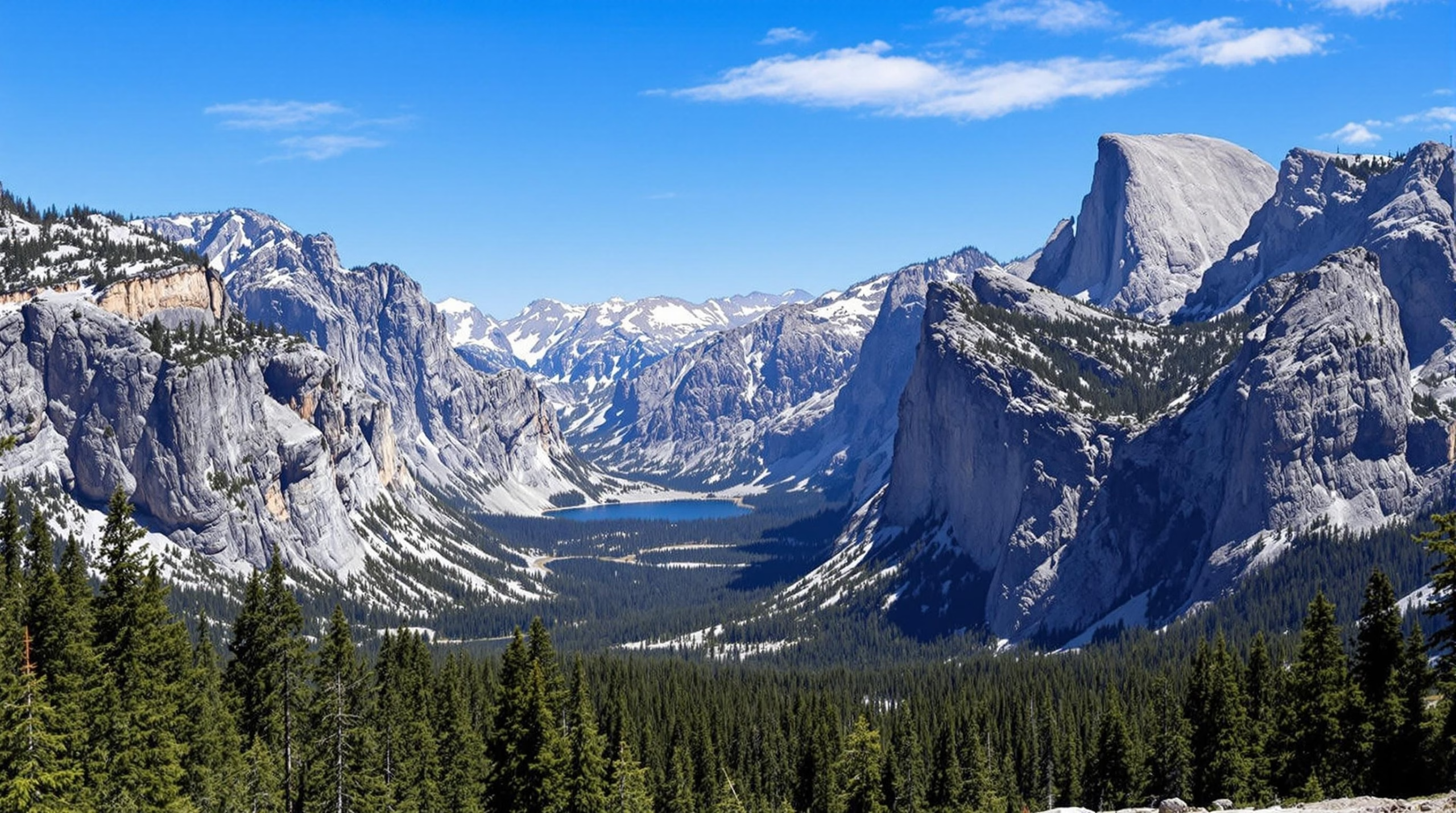
This is arguably the most scenic and direct route between Lake Tahoe and Yosemite Valley, entering the park through the Tioga Pass Entrance. Starting from South Lake Tahoe, travelers head south on U.S. Route 395, a stunning highway that runs along the eastern Sierra Nevada, passing through picturesque towns like Bridgeport and Lee Vining. From there, Highway 120 (Tioga Road) climbs into Yosemite through Tioga Pass, the highest vehicle-accessible pass in California at 9,945 feet.
Highlights Along the Way:
- Mono Lake’s otherworldly tufa formations
- Lee Vining and the Mono Basin Scenic Area
- Tuolumne Meadows, a high-alpine Yosemite gem
- Olmsted Point and Tenaya Lake
This route offers unparalleled alpine scenery and is ideal for travelers wanting to experience the less-crowded eastern side of Yosemite. However, it’s important to verify road conditions before departure, as Tioga Pass closes in winter due to heavy snow.
CA-88 and CA-120 Northern Route
Distance: Approximately 180–200 miles
Estimated Drive Time: 5–6 hours
Availability: Year-round (weather permitting)
For travelers making the journey in winter or early spring when Tioga Pass is closed, the CA-88 and CA-120 route offers a reliable alternative. From South Lake Tahoe, drivers take CA-88 west through scenic mountain passes, then connect to CA-49 and eventually CA-120 into the park’s Big Oak Flat Entrance, located on the western side of Yosemite.
Highlights Along the Way:
- Carson Pass and Silver Lake
- Historic Gold Rush towns like Jackson and Sonora
- Stanislaus National Forest
- Groveland, a charming gateway town to Yosemite
While this route is longer and less alpine in nature, it is rich in California history and offers access to Yosemite Valley year-round, making it a practical and scenic option during winter months.
El Portal Road / Arch Rock Entrance (via CA-140)
Distance: Approximately 200–220 miles
Estimated Drive Time: 5–6.5 hours
Availability: Year-round
This route is ideal for those seeking the most direct access to Yosemite Valley when Tioga Pass is closed. From Lake Tahoe, the drive typically involves heading west to CA-49 south, then connecting to CA-140 east at Mariposa. CA-140 follows the scenic Merced River canyon and enters the park via the Arch Rock Entrance near El Portal.
Highlights Along the Way:
- Mariposa’s historic downtown and museums
- Wild and Scenic Merced River corridor
- Abundant spring wildflowers and wildlife viewing
- Direct access to Yosemite Valley attractions
This route is known for its relatively moderate elevation and tends to remain open even in winter. However, it can be affected by rockslides and roadwork, so travelers should check current conditions before departure.
Summary of Route Options
| Route | Distance | Drive Time | Seasonal Access | Entrance |
|---|---|---|---|---|
| Tioga Pass (CA-120 East) | ~160 miles | 4–5 hrs | Late May–Oct | East Entrance |
| CA-88 & CA-120 | ~190 miles | 5–6 hrs | Year-round | Big Oak Flat |
| CA-140 / El Portal | ~210 miles | 5–6.5 hrs | Year-round | Arch Rock |
Each route offers a unique perspective on California’s diverse landscapes, from alpine lakes and granite cliffs to Gold Rush-era towns and river canyons. Careful planning based on the season and your desired destinations within Yosemite will help you choose the best route for an unforgettable road trip.
Seasonal Considerations
When planning a road trip from Lake Tahoe to Yosemite National Park, understanding the seasonal dynamics is essential to ensure a safe and enjoyable journey. The Sierra Nevada region is known for its dramatic weather shifts and road closures due to snow, especially at higher elevations. The time of year you travel will significantly impact route availability, travel time, and the type of outdoor experiences you can enjoy.
Winter Travel (November to April)
Winter in the Sierra Nevada can be both breathtaking and challenging. Snowfall is common from late fall through early spring, especially at higher elevations near Lake Tahoe and Yosemite's eastern entrances.
- Tioga Pass (Highway 120 East): The Tioga Pass, the most direct and scenic route connecting Lake Tahoe to Yosemite’s eastern entrance, is typically closed from November through late May or early June due to snow. This closure can significantly alter travel plans, requiring detours via lower elevation routes.
- Road Conditions: Snow chains may be required, and road closures can occur with little notice. Always check Caltrans road updates before setting out.
- Travel Experience: While some areas remain accessible, many trails and facilities in Yosemite are limited or closed in winter. However, this season offers fewer crowds and a magical snowy landscape for those prepared for winter conditions.
Spring Travel (May to Early June)
Spring is a transitional season in the Sierra, with variable weather and changing accessibility.
- Tioga Pass Reopening: Depending on snowpack levels, Tioga Pass may begin to open in late May or early June. This timing varies yearly and is crucial for route planning.
- Waterfalls and Wildflowers: Spring is one of the best times to witness Yosemite’s waterfalls at peak flow, fed by melting snow. Wildflowers also begin to bloom, especially in lower elevations.
- Crowd Levels: Compared to summer, spring sees fewer visitors, particularly in early May, making it a good balance between accessibility and solitude.
Summer Travel (Late June to September)
Summer is the most popular time to travel between Lake Tahoe and Yosemite, offering full access to most routes and attractions.
- Tioga Pass Fully Open: By late June, Tioga Pass is generally open, allowing travelers to take this spectacular high-elevation route from Lake Tahoe to Yosemite Valley.
- Warm Weather and Longer Days: Ideal for hiking, camping, and sightseeing, summer provides the best conditions for outdoor adventures.
- Crowds and Reservations: Summer is peak tourist season, so expect heavy traffic, especially in Yosemite Valley. Accommodation and park entry reservations are often required well in advance.
Fall Travel (Late September to October)
Autumn offers cooler temperatures, changing foliage, and a quieter park experience.
- Fewer Crowds: After Labor Day, visitor numbers begin to drop, making this a more peaceful time to visit both Lake Tahoe and Yosemite.
- Road Access: Tioga Pass typically remains open until mid-October, depending on the onset of snow. Always monitor forecasts, as early storms can cause sudden closures.
- Scenic Beauty: Fall foliage in the Sierra Nevada can be stunning, with aspen groves near the Tioga Pass and higher elevations adding vibrant color to the landscape.
Route Planning by Season
Choosing the right route between Lake Tahoe and Yosemite depends heavily on the time of year:
- Summer & Early Fall: Tioga Pass via Highway 120 East is the most direct and scenic option and is generally accessible from late June through mid-October.
- Winter & Early Spring: Use lower elevation routes such as CA-88 to CA-49 or CA-120 West. These roads remain open year-round but may still experience winter driving conditions.
- Shoulder Seasons (May & October): Flexibility is key, as route availability can change rapidly. Have alternate routes and accommodations in mind.
By understanding these seasonal patterns, travelers can better prepare for a safe and memorable road trip between Lake Tahoe and Yosemite National Park.
Distance and Basic Planning
The journey from Lake Tahoe to Yosemite National Park covers approximately 150 to 200 miles, depending on the chosen route. The drive typically takes between 4 to 6 hours without extended stops. However, the trip duration can vary significantly based on weather conditions, road closures, and sightseeing stops along the way.
If you’re traveling during the summer months, the most scenic and direct route is via Tioga Pass (Highway 120 through the eastern Sierra), which is usually open from late May to early November, depending on snow levels. During the winter and early spring, this pass is closed, requiring alternate routes that add both distance and drive time.
Recommended Trip Duration
To fully enjoy the journey, a 3 to 5-day trip is ideal. This allows time to explore Lake Tahoe’s natural beauty, experience the scenic drive, and spend at least two days immersed in Yosemite National Park’s iconic landscapes.
Getting to the Starting Point
Transportation Options to Lake Tahoe
Lake Tahoe is accessible by car from major California cities, including Sacramento (about 2 hours) and San Francisco (about 3.5 hours). Travelers flying in can choose from several nearby airports:
- Reno-Tahoe International Airport (RNO) – Approx. 1 hour from North Lake Tahoe
- Sacramento International Airport (SMF) – Approx. 2 hours from South Lake Tahoe
Public Transportation Alternatives
While Lake Tahoe is best explored by car, limited public transportation options exist. Amtrak and Greyhound offer services to nearby towns like Truckee, with local shuttles available to reach Tahoe. However, for the road trip to Yosemite, a rental car is highly recommended.
Rental Car Information
Renting a reliable vehicle gives you the flexibility to explore scenic byways and reach remote trailheads. A standard car suffices in summer, but during early spring or late fall, an all-wheel-drive or 4WD vehicle is preferable due to possible snow or icy conditions in higher elevations.
Route Options Analysis
Tioga Pass Route (Highway 120 East Entrance)
- Distance: Approximately 150–170 miles
- Estimated Drive Time: 4 to 5 hours
- Seasonal Availability: Late May through early November
- Highlights: This is the most scenic and direct route, passing through the Sierra Nevada. Travelers can enjoy Mono Lake, Tuolumne Meadows, and Tenaya Lake before reaching Yosemite Valley.
Note: Always check the current status of Tioga Pass through the National Park Service website before planning your trip.
CA 88 & CA 120 Northern Route
- Distance: Around 200 miles
- Estimated Drive Time: 5 to 6 hours
- Year-Round Accessibility: This route is ideal when Tioga Pass is closed due to snow.
- Key Stops: Kirkwood, Markleeville, Groveland, and the Stanislaus National Forest offer beautiful detours and rest stops.
This route joins Highway 120 West, entering Yosemite via the Big Oak Flat Entrance.
El Portal Road / Arch Rock Entrance
- Accessed Via: Highway 140
- Best For: Entering Yosemite when coming from the western side, especially during winter months.
- Route Characteristics: Slightly longer drive, often used when staying in nearby towns like Mariposa or El Portal. This entrance provides a gradual elevation gain, making it suitable for RVs and larger vehicles.
Accommodation Guide
Lake Tahoe Lodging
- Best Areas to Stay: South Lake Tahoe (more amenities and nightlife), North Lake Tahoe (quieter, more nature-focused)
- Types of Accommodation: Resorts, lodges, vacation rentals, and campgrounds
- Price Ranges: Budget motels start around $100 per night, while high-end lakeside resorts can exceed $400 per night
Yosemite Lodging
- In-Park Options: Yosemite Valley Lodge, Curry Village, and The Ahwahnee (reservations often required 6–12 months in advance)
- Nearby Towns: Groveland, El Portal, Mariposa, and Oakhurst offer motels and B&Bs within 30 to 60 minutes of park entrances
- Camping: Yosemite offers several campgrounds, but many require advance reservations and fill up quickly during peak season
Trip Planning Tips
- Best Time to Travel: June through September for full access to all Yosemite areas via Tioga Pass. Spring and fall offer cooler weather and fewer crowds.
- Permits: A park entrance fee is required ($35 per vehicle for a 7-day pass). Wilderness permits are needed for overnight backcountry hiking.
- Essential Items to Pack: Reusable water bottles, layered clothing, sun protection, maps or GPS devices with offline functionality, and tire chains (if traveling in early spring or late fall)
- Reservations: Summer travelers should book accommodations and park entries well in advance. Yosemite now requires reservations during peak periods—check the National Park Service website for up-to-date info.
Navigation and Safety
- Navigation Tips: Cell service is limited in many mountainous areas, so download offline maps or carry a paper road atlas.
- Emergency Preparedness: Carry extra food, water, flashlight, first-aid kit, and a portable phone charger. Always check road and weather conditions before departure via Caltrans or the NPS website.
Additional Travel Information
Entry Permits and Park Passes
Travelers heading from Lake Tahoe to Yosemite National Park should be aware of necessary entry requirements. Yosemite National Park requires either a park entrance fee or a valid pass. The standard entrance fee for a private vehicle is $35 and is valid for seven consecutive days. Alternatively, the America the Beautiful Pass, which costs $80 annually, grants access to all U.S. national parks and federal recreation lands and is a great value for frequent travelers.
During peak travel months, especially between May and September, Yosemite National Park may implement a reservation system for entry due to high visitor numbers. It's recommended to check the official National Park Service (NPS) website to confirm if a reservation is required for your travel dates.
Road Closures and Seasonal Accessibility
Tioga Pass (Highway 120 East), the most direct and scenic route between Lake Tahoe and Yosemite, is typically closed from late October through late May or early June due to heavy snowfall. Travelers planning to use this route should monitor current road conditions and seasonal opening dates on the Caltrans website or the NPS road conditions page.
Alternative routes such as CA-88 and CA-120 or U.S. Route 395 remain accessible year-round, though winter storms may still impact driving conditions. Chains or snow tires may be required during the winter months, particularly in higher elevations.
Cell Service and Connectivity
Cell coverage is limited or non-existent throughout much of Yosemite National Park and along some stretches of the drive from Lake Tahoe, especially in more remote or mountainous areas. It's advisable to download offline maps and any necessary travel documents in advance. Travelers may also consider carrying a physical map or road atlas.
Fuel and Charging Stations
Gas stations are available in most towns along the route, including South Lake Tahoe, Gardnerville, Bridgeport, and Lee Vining. However, distances between fuel stops can be significant, especially when traveling via U.S. 395 and Tioga Pass. It's wise to fill up your tank before entering more remote areas.
For electric vehicle (EV) drivers, charging stations are available in South Lake Tahoe and Mammoth Lakes, and limited EV chargers can be found near Yosemite, including at the Tenaya Lodge and Yosemite Valley Lodge. However, availability may vary, so it's important to plan charging stops in advance.
Wildlife and Safety Tips
Both Lake Tahoe and Yosemite are home to diverse wildlife, including black bears, deer, and coyotes. Visitors should store food properly in bear-proof containers and avoid leaving any scented items in vehicles. While encounters with wildlife are typically safe, maintaining a respectful distance is essential.
Road conditions can change rapidly in mountainous terrain, especially during spring and fall shoulder seasons. Always check weather forecasts, carry extra water, warm clothing, and ensure your vehicle is road-ready with a spare tire and emergency kit.
Local Regulations and Leave No Trace
To preserve the natural beauty of both destinations, travelers are encouraged to follow Leave No Trace principles. This includes packing out all trash, staying on marked trails, and respecting wildlife. Campfires may be restricted during dry months due to wildfire risk, so always check local fire regulations before lighting a fire or using camp stoves.
Yosemite also has strict rules about camping locations, noise, and overnight stays. If you plan to camp, make sure to secure reservations well in advance, especially during peak season, as campgrounds inside the park fill up quickly.
Visitor Centers and Information Points
Visitor centers in both Lake Tahoe and Yosemite offer maps, current conditions, and expert advice. Key stops include:
- Taylor Creek Visitor Center (South Lake Tahoe)
- Yosemite Valley Visitor Center
- Big Oak Flat Information Station (for those entering via CA-120)
- Tuolumne Meadows Visitor Center (seasonal; along Tioga Road)
These centers are excellent places to get up-to-date information on trail conditions, park alerts, and ranger-led programs.
Cultural and Historical Sites
Beyond natural beauty, this route is rich in California history. Consider visiting Bodie State Historic Park, a preserved ghost town near Bridgeport, or the Mono Lake Tufa State Natural Reserve, which offers insights into the region's unique geology and ecology. These side trips add cultural depth to the journey and are relatively close to the main route between Lake Tahoe and Yosemite.
By taking these additional travel details into account, road trippers can ensure a more enjoyable, safe, and well-prepared adventure through two of California’s most iconic destinations.
From alpine panoramas and scenic byways to historic detours and national park wonders, the drive from Lake Tahoe to Yosemite National Park delivers a quintessential California road trip. Whether you take the fast route in summer via Tioga Pass or opt for reliable all-season highways, each journey offers rewarding views and must-see stops. Plan around the seasons, check current conditions, and get ready for an unforgettable adventure between two of the state’s most incredible natural gems.