Congaree National Park’s landscape was shaped by ancient tectonic activity, particularly through the movements of the North American Plate, as well as interactions with the African Plate and South American Plate during the formation and breakup of Pangaea. Though the park is not in a tectonically active area today, past geological processes, including mountain-building events, erosion, and sediment deposition, played a crucial role in creating its distinctive floodplain ecosystem.
## Historical Tectonic Activity
Formation of the Southeastern United States
The geological history of Congaree National Park is deeply rooted in the tectonic activity that shaped the southeastern United States. The region is part of the Atlantic Coastal Plain, which formed as a result of complex interactions between tectonic plates over hundreds of millions of years.
During the Paleozoic Era (roughly 541 to 252 million years ago), the land that now comprises South Carolina was influenced by the assembly and breakup of the supercontinent Pangaea. The collision of the ancient North American plate with other landmasses, including the African and South American plates, led to significant mountain-building events, such as the formation of the Appalachian Mountains. Though Congaree National Park itself is not mountainous, the erosion of these ancient formations contributed to the sediments that now define the park's floodplain.
Tectonic Influence on the Coastal Plain
During the Mesozoic Era (252 to 66 million years ago), the breakup of Pangaea led to the formation of the Atlantic Ocean. As the North American plate drifted westward, the southeastern coastline of the continent underwent subsidence, creating the Atlantic Coastal Plain. Over millions of years, sediment from the eroding Appalachian Mountains was transported by rivers, gradually depositing layers of sand, silt, and clay that define the geology of Congaree National Park.
Although this region is not currently tectonically active, past movements of the North American plate helped shape the broad, low-lying floodplain that characterizes the park today. The absence of recent tectonic uplift means that the Congaree River continues to meander, depositing sediments that sustain the park’s unique ecosystem.
Seismic Activity in the Region
While South Carolina is not known for frequent large earthquakes, it has experienced significant seismic events in the past. The Charleston Earthquake of 1886, one of the most powerful earthquakes in the eastern United States, was caused by reactivation of ancient fault lines that date back to the breakup of Pangaea. Though Congaree National Park is located inland from Charleston, the region is still subject to occasional minor seismic activity due to these ancient fault structures.
Long-Term Geological Evolution
The geological evolution of Congaree National Park is a testament to the dynamic forces that have shaped North America over hundreds of millions of years. From the formation of the Appalachian Mountains to the gradual deposition of sediment in the Coastal Plain, tectonic activity has played a crucial role in the development of the park’s landscape. Today, while tectonic forces no longer actively reshape the region, the legacy of past plate movements continues to influence the park’s geology and hydrology.
Geological Features and Formations
The Influence of Tectonic Activity
Congaree National Park's geological evolution is deeply connected to the movement of tectonic plates. The park lies within the Atlantic Coastal Plain, a region shaped by the breakup of the supercontinent Pangaea during the Mesozoic Era. The separation of the North American and African plates played a crucial role in shaping the southeastern United States, including the floodplain landscapes found in Congaree. Over millions of years, shifting tectonic forces contributed to the deposition of sediments that now define the park's terrain.
Alluvial Floodplain and River Dynamics
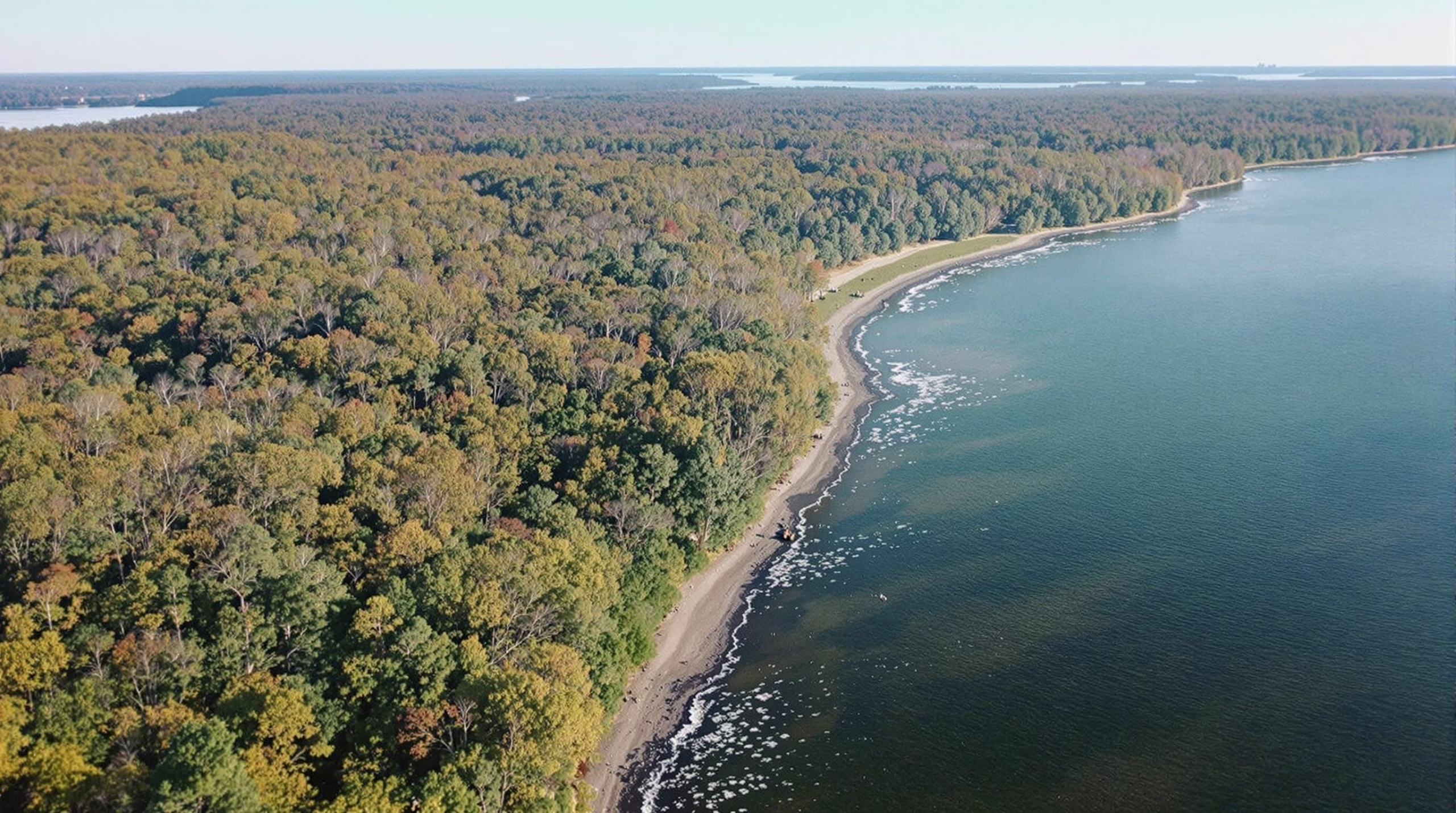
One of the most distinctive geological features of Congaree National Park is its extensive alluvial floodplain. The Congaree River, which meanders through the park, has played a pivotal role in shaping the land. Over time, the river has deposited layers of sediments—sand, silt, and clay—carried from the Appalachian Mountains. These deposits have created a fertile floodplain that supports the park’s famous old-growth bottomland hardwood forest. Seasonal flooding continues to reshape the landscape, influencing soil composition and nutrient distribution.
Oxbow Lakes and Natural Levees
The park also features oxbow lakes, remnants of former river channels that have been cut off due to meandering river patterns. These crescent-shaped lakes, such as Weston Lake, provide evidence of the river's dynamic history. Additionally, natural levees—elevated ridges formed by sediment deposition during floods—are present along the riverbanks. These formations contribute to the diverse microhabitats within the park, supporting a wide range of plant and animal species.
Fossil Records and Sedimentary Deposits
While Congaree National Park is not known for extensive fossil discoveries, its sedimentary layers contain clues about past environments. The park’s soils primarily consist of Quaternary alluvial deposits, which include materials transported from the Piedmont and Appalachian regions. These deposits indicate periods of climatic change and shifts in river dynamics over thousands of years.
The Role of Erosion and Weathering
Erosion and weathering have significantly influenced the park’s topography. The slow breakdown of rock and soil by water and wind continues to shape the landscape. The constant movement of sediments, especially during seasonal flooding, alters the park’s surface features over time. This ongoing process ensures that Congaree’s geological landscape remains ever-changing.
Geological Research and Mapping
Scientists and geologists have conducted studies to understand the park’s geological history. Geological maps of the region highlight the composition of the floodplain and the sediment transport processes that have shaped it. Research in hydrology and sedimentology continues to provide insights into the long-term changes occurring within the park’s ecosystem.
By exploring these geological features and formations, visitors and researchers alike can gain a deeper appreciation of the natural forces that have shaped Congaree National Park over millions of years.
Modern Geological Processes
Congaree National Park continues to be shaped by ongoing geological forces that influence its landscape. These modern processes contribute to the park’s dynamic environment, affecting sediment deposition, erosion, and hydrological patterns.
Fluvial Processes and Sediment Deposition
The Congaree River plays a critical role in shaping the park’s floodplain ecosystem. Seasonal flooding carries sediments from upstream, depositing rich alluvial soils that support the park’s diverse plant life. These deposits are essential in maintaining the unique bottomland hardwood forest that defines Congaree. The river’s meandering nature also influences sediment redistribution, creating oxbow lakes and natural levees over time.
Tectonic Activity and Landform Evolution
Although Congaree National Park is not located in an area of high tectonic activity, the region's geological history has been influenced by the movement of the North American Plate. The Appalachian Mountains, to the northwest, were formed through ancient tectonic collisions, and although no major faults directly impact the park today, minor seismic activity occasionally occurs due to stresses within the plate. These subtle movements can contribute to shifts in the landscape, influencing drainage patterns and erosion processes.
Erosion and Soil Dynamics
Erosion is an ongoing process in the park, particularly along riverbanks and flood channels. Water flow continually shapes the terrain by eroding softer sediments and depositing them elsewhere. Tree roots help stabilize the soil, but storm events and flooding can lead to localized erosion, altering the park’s topography over time.
Climate Influence on Geological Processes
Climate plays a vital role in the park’s geological changes. Increased rainfall can enhance river flow, leading to more significant erosion and sediment transport. Conversely, periods of drought can reduce water movement, affecting sediment deposition rates. Climate change may also influence flood frequencies, potentially altering the park's floodplain dynamics and long-term geological development.
These modern geological processes ensure that Congaree National Park remains a dynamic and evolving landscape, showcasing the ongoing interaction between natural forces and the environment.
Environmental Impact and Conservation
Human Influence on the Park Ecosystem
Congaree National Park, like many protected areas, faces environmental challenges due to human activities. While the park itself is preserved, external influences such as urban development, pollution, and climate change can affect its ecosystem. Runoff from nearby agricultural and industrial areas can introduce pollutants into the park’s waterways, impacting water quality and aquatic life. Additionally, air pollution from surrounding regions may contribute to soil degradation and affect the growth of the park’s iconic bottomland hardwood forest.
Climate Change and Its Effects
Climate change poses a significant threat to Congaree National Park. Rising temperatures and shifting precipitation patterns can lead to alterations in the park’s floodplain ecosystem. The park experiences seasonal flooding, which is essential for nutrient distribution, but changes in rainfall intensity and frequency may disrupt this natural cycle. Increased occurrences of extreme weather events, such as hurricanes and heavy storms, can lead to more severe flooding or prolonged droughts, impacting plant and animal life.
Conservation Efforts and Habitat Protection
Efforts to conserve the park’s unique ecosystem involve both governmental and community initiatives. The National Park Service (NPS) actively monitors environmental conditions, implements habitat restoration projects, and enforces regulations to minimize human impact. Conservation programs focus on protecting the old-growth forest, maintaining water quality, and preserving biodiversity.
The park also collaborates with researchers to study long-term ecological changes. Scientific studies help determine how best to manage invasive species, protect endangered wildlife, and mitigate climate-related threats. Public awareness campaigns and educational programs encourage responsible park visitation and promote sustainable practices.
The Role of Tectonic Activity in Landscape Evolution
Though Congaree National Park is not located in an area of high tectonic activity, the geological history of the southeastern United States has played a role in shaping its landscape. The region’s geology is influenced by the movement of the North American Plate, which has contributed to the formation of the Atlantic Coastal Plain. Over millions of years, sediment deposition from ancient rivers and shifting sea levels have helped shape the park’s floodplain environment.
While tectonic activity does not directly impact the park today, past geological processes have influenced soil composition, hydrology, and the overall terrain. Understanding these foundational changes helps conservationists manage the park’s natural resources effectively.
Sustainable Visitor Practices
To ensure the long-term preservation of Congaree National Park, visitors are encouraged to follow sustainable practices. Staying on designated trails, properly disposing of waste, and respecting wildlife habitats are essential actions that help minimize human impact. The park also promotes Leave No Trace principles, which emphasize responsible outdoor ethics to protect natural areas for future generations.
Educational programs and guided tours provide visitors with insights into the park’s ecological importance and the role they can play in conservation. By fostering a deeper appreciation for the park’s natural beauty and scientific significance, these efforts contribute to ongoing environmental stewardship.
While tectonic activity no longer actively reshapes Congaree National Park, its geological history remains vital in understanding its unique landscape. Past plate movements contributed to the park’s rich floodplain environment, sustained by erosion and sediment deposition. Visitors and researchers alike can appreciate how ancient forces shaped the terrain, making conservation efforts crucial to preserving this dynamic ecosystem.