Sequoia National Park is approximately 190 miles (~305 km) from San Francisco in a straight line, but the actual driving distance ranges between 220 to 280 miles (~354 to 450 km), depending on your chosen route. The journey takes 4.5 to 6 hours by car, with various scenic and efficient paths to explore. Whether you're planning a road trip or looking for alternative transport options, this guide covers the best routes, seasonal considerations, and essential travel tips for a smooth journey.
Direct Distance and Route Options
Distance from San Francisco to Sequoia National Park
The direct distance between San Francisco and Sequoia National Park is approximately 190 miles (305 km). However, due to the mountainous terrain and the lack of a straight highway connecting the two locations, the actual driving distance is significantly longer. The most commonly used driving routes cover between 220 to 280 miles (354 to 450 km), depending on the specific path chosen.
On average, the drive takes 4.5 to 6 hours, but this duration can vary based on traffic conditions, weather, and road closures, particularly in winter months when higher elevations may experience snowfall.
Primary Driving Routes
There are several ways to travel from San Francisco to Sequoia National Park, each offering different advantages in terms of travel time, scenery, and accessibility.
Route 1: Via CA-99 and CA-198 (Fastest Route)
- Distance: Approximately 230 miles (370 km)
- Estimated Driving Time: 4.5 to 5.5 hours
- Key Roads: I-580 E → I-5 S → CA-99 S → CA-198 E
- Highlights:
- Passes through major Central Valley cities like Modesto, Merced, and Fresno
- Provides access to Visalia, a common gateway to Sequoia National Park
- Directs travelers to the Ash Mountain Entrance via CA-198
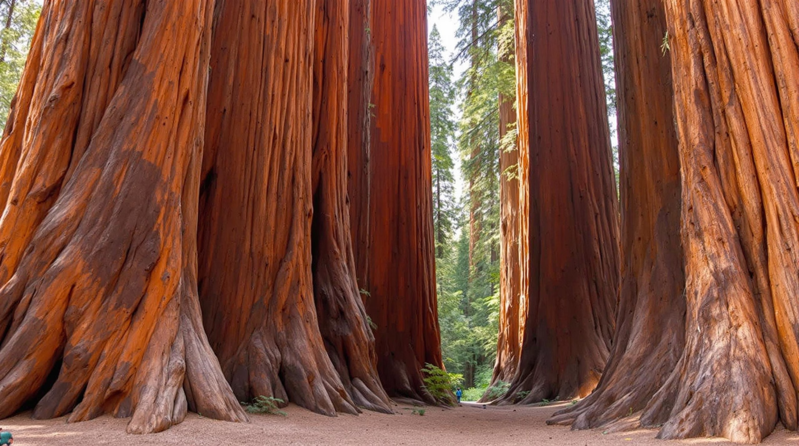
This is the most commonly recommended route, as it offers the shortest drive time and the most direct access to the park’s main attractions, including the Giant Forest and General Sherman Tree.
Route 2: Via I-5 and CA-65 (Scenic Alternative)
- Distance: Approximately 250 miles (402 km)
- Estimated Driving Time: 5 to 6 hours
- Key Roads: I-580 E → I-5 S → CA-65 S → CA-198 E
- Highlights:
- Offers a more scenic drive through California’s rolling hills and agricultural landscapes
- Bypasses some of the traffic congestion around Fresno
- Provides an alternative approach to the park, entering via Visalia
This route is slightly longer but can be a good option for those looking to avoid heavy traffic on CA-99.
Route 3: Via I-5 and CA-180 (Access to Kings Canyon)
- Distance: Approximately 270 miles (435 km)
- Estimated Driving Time: 5.5 to 6 hours
- Key Roads: I-580 E → I-5 S → CA-99 S → CA-180 E
- Highlights:
- Ideal for travelers who also want to visit Kings Canyon National Park
- Takes drivers through Fresno before leading into the Grant Grove area of Kings Canyon
- Offers an alternative entry point into Sequoia National Park via the Big Stump Entrance
If you plan to explore both Sequoia and Kings Canyon National Parks, this route may be the best option.
Alternative Travel Methods
For those who prefer not to drive, alternative transportation options are limited but available:
- Bus Services: Greyhound and other bus operators provide routes from San Francisco to Visalia, where a shuttle service to Sequoia National Park is available during certain seasons.
- Train Travel: Amtrak offers service to Fresno, from where travelers can rent a car or take a bus to the park.
- Flights: The nearest major airport is Fresno Yosemite International Airport (FAT), located about 80 miles from Sequoia National Park. From Fresno, a rental car is needed to reach the park.
Seasonal Considerations
- Summer (June–September): The best time for a smooth trip, with all park roads accessible and no snow-related closures.
- Winter (December–March): Some park roads, including Generals Highway, may be closed or require tire chains due to snow and ice.
- Spring & Fall: Shoulder seasons offer fewer crowds, but visitors should check for early or late snowfall that may impact driving conditions.
Choosing the right route depends on your travel preferences, time constraints, and whether you plan to explore additional destinations along the way.
Transportation Methods and Times
Driving from San Francisco to Sequoia National Park
The most common and convenient way to travel from San Francisco to Sequoia National Park is by car. The driving distance is approximately 280 to 300 miles, depending on the chosen route, and the journey typically takes 5 to 6 hours under normal traffic conditions. The most popular route follows Interstate 580 East, merging onto Interstate 5 South, then continuing on Highway 99 South before taking Highway 198 East into the park.
Best Driving Routes
- Via I-5 South and CA-198 East (Fastest Route): This is the most direct and commonly used route, with well-maintained highways and access to major cities like Fresno and Visalia for refueling and rest stops.
- Via CA-99 South and CA-198 East: A slightly longer alternative that passes through more urban areas, including Modesto and Fresno, offering more dining and accommodation options.
- Scenic Route via CA-152 East and CA-41 South: Travelers looking for a more picturesque drive may take this route, which passes through rolling hills and agricultural landscapes before connecting to CA-198 toward the park.
Estimated Driving Time
- Without stops: Approximately 5 to 6 hours
- With breaks and sightseeing: 6 to 8 hours, depending on traffic and road conditions
Public Transportation Options
For those who prefer not to drive, public transportation options are available, though they require multiple transfers and additional travel time.
Bus and Train Services
- Amtrak Train + Bus: Travelers can take an Amtrak train from San Francisco to Fresno, which takes about 3 to 4 hours. From Fresno, the Yosemite Area Regional Transportation System (YARTS) or Sequoia Shuttle can provide access to the park.
- Greyhound Bus: A Greyhound bus from San Francisco to Visalia takes approximately 4 to 5 hours, followed by a connection to the Sequoia Shuttle for park access.
Sequoia Shuttle
- Operates seasonally from Visalia to Sequoia National Park
- Travel time from Visalia to the park: 1.5 to 2 hours
- Affordable option for those without a personal vehicle
Alternative Transportation Methods
- Ridesharing (Uber/Lyft): Long-distance rideshare services are available but can be costly, typically $250 to $400 one-way. Availability may also be limited in remote areas.
- Private Shuttle Services: Some tour companies offer direct shuttle services from San Francisco to Sequoia National Park, though these are often part of guided tours rather than standard transportation.
- Air Travel + Rental Car: Travelers can fly from San Francisco International Airport (SFO) to Fresno Yosemite International Airport (FAT) in about 1 hour, then rent a car for the 1.5-hour drive to the park.
Travel Time Comparisons
| Transportation Method | Estimated Travel Time | Notes |
|---|---|---|
| Driving (fastest route) | 5-6 hours | Most convenient and flexible option |
| Amtrak + Bus | 6-8 hours | Requires multiple transfers |
| Greyhound + Shuttle | 6-8 hours | Limited service availability |
| Uber/Lyft | 5-6 hours | Expensive for long distances |
| Flight + Rental Car | 4-5 hours | Fastest alternative but may be costly |
Each mode of transportation has its advantages, and the best choice depends on budget, time constraints, and personal preference. Travelers should also consider seasonal conditions, as winter weather can impact road accessibility in the park.
Route Planning Considerations
Distance and Estimated Travel Time
The journey from San Francisco to Sequoia National Park spans approximately 280 to 300 miles, depending on the chosen route. The estimated driving time typically ranges between 5 to 6 hours without major stops or delays. However, factors such as traffic congestion, road conditions, and seasonal weather can impact travel time.
Best Routes and Highways
There are two primary routes to consider when traveling from San Francisco to Sequoia National Park:
-
Via CA-99 South (Recommended Route)
- Take I-580 E from San Francisco
- Merge onto I-205 E, then I-5 S toward Stockton
- Continue on CA-99 S through Fresno
- Take CA-198 E from Visalia, leading to the park entrance
Key Benefits:
- This route provides the most direct and efficient path to the park.
- Major cities along the way offer ample dining, fuel, and rest stops.
-
Via I-5 South and CA-198 East (Alternative Route)
- Follow I-5 S from San Francisco
- Take CA-198 E near Coalinga to enter the park
Key Benefits:
- Fewer urban areas, making for a smoother drive with less congestion.
- Slightly longer but offers an alternative for those preferring highway travel over city traffic.
Seasonal Considerations
Weather conditions in Sequoia National Park can vary significantly depending on the time of year.
-
Spring & Summer (April – September):
- Ideal for travel due to clear roads and warm weather.
- Expect moderate to high visitor traffic, especially in summer.
-
Fall (October – November):
- Cooler temperatures with fewer crowds.
- Some facilities may begin closing for the winter season.
-
Winter (December – March):
-
Snow and ice can make driving conditions hazardous, especially on mountain roads.
-
Tire chains may be required, particularly on roads leading into higher elevations.
-
Some roads and park areas may be closed due to snowfall.
Alternative Route Options
For travelers looking to add scenic detours or explore additional attractions along the way, the following options can enhance the experience:
-
Yosemite National Park Detour:
- Travelers can take CA-120 E to visit Yosemite before heading south to Sequoia via CA-41 S and CA-99 S.
- This adds approximately 2 to 3 hours of driving but offers breathtaking views of Yosemite Valley.
-
Pacific Coast Highway (Scenic Route):
- Drive south along Highway 1 through Monterey and Big Sur before cutting inland toward Sequoia.
- While significantly longer, this route provides some of California’s most stunning coastal views.
By carefully planning the route and considering seasonal travel factors, visitors can ensure a smooth and enjoyable road trip from San Francisco to Sequoia National Park.
Seasonal Impact on Travel Time
The time it takes to drive from San Francisco to Sequoia National Park, which is approximately 280 miles (450 kilometers), can vary significantly depending on the time of year. Seasonal factors such as weather conditions, road closures, and traffic congestion can all influence the total travel duration.
Summer Travel Considerations
Summer is the most popular time to visit Sequoia National Park, as the weather is generally warm and all park roads and facilities are open. However, this also means heavier traffic on highways and within the park. Visitors should expect increased congestion, particularly on weekends and holidays, which can extend travel time. Additionally, more vehicles on the road can lead to delays at gas stations and rest stops.
Winter Travel Challenges
Winter presents a different set of challenges for travelers heading to Sequoia National Park. Snowfall is common at higher elevations, including areas leading into the park, which can result in road closures or mandatory tire chains. Highway 198, one of the main access roads, can become icy and hazardous, leading to slower driving conditions. In extreme cases, portions of the park may be inaccessible, requiring travelers to take alternative routes or adjust their plans.
Spring and Fall Transitions
Spring and fall offer a balance between accessibility and manageable traffic conditions. In spring, melting snow can lead to wet roads and occasional flooding in lower elevations, potentially causing minor delays. Fall, on the other hand, provides excellent driving conditions with cooler temperatures and fewer crowds. However, early snowfall in late fall can sometimes affect travel times, particularly in November.
Best Time for a Smooth Journey
For the most efficient and stress-free driving experience, late spring (May to early June) and early fall (September to October) are ideal. These periods offer mild weather, lower traffic volumes, and full access to park roads without the complications of peak summer congestion or winter road hazards. Travelers should always check weather forecasts and park road conditions before starting their journey to ensure a safe and timely arrival.
Journey Break Points
When traveling from San Francisco to Sequoia National Park, the journey typically takes around 4.5 to 5.5 hours, covering a distance of approximately 230 to 260 miles, depending on the chosen route. To make the most of the trip, it’s beneficial to plan break points along the way. These stops provide opportunities to rest, refuel, and explore interesting sights, making the drive more enjoyable and manageable.
Major Cities and Towns for Rest Stops
Several cities and towns along the route offer ideal locations for rest stops, dining, and fuel refills:
- San Jose – Located about an hour south of San Francisco, San Jose offers a variety of restaurants, coffee shops, and gas stations. It’s a great place to grab breakfast or stock up on road trip essentials.
- Gilroy – Known as the "Garlic Capital of the World," Gilroy is a good place for a quick stop, with rest areas, fast food options, and the Gilroy Premium Outlets for shopping enthusiasts.
- Los Banos – Situated along I-5, Los Banos offers a convenient midway stop with fuel stations, restaurants, and rest areas. It’s a good place to stretch your legs before continuing the journey.
- Fresno – As the largest city near Sequoia National Park, Fresno is an excellent place to make a longer stop. Travelers can find a wide range of dining options, hotels, and grocery stores for last-minute supplies.
Scenic and Recreational Stops
For those who want to break up the drive with some sightseeing, there are several scenic and recreational spots worth considering:
- San Luis Reservoir State Recreation Area – Located off Highway 152, this reservoir offers picnic areas and scenic viewpoints, making it a peaceful spot to take a break from driving.
- Kaweah Lake – Near Visalia, this lake provides a nice detour for those who want to enjoy a brief scenic stop before heading into the mountains.
Gas Stations and Facilities
Ensuring your vehicle is fueled before entering the mountainous regions is crucial, as gas stations become less frequent. Recommended refueling points include:
- Fresno – Multiple gas stations available, including major chains.
- Visalia – A good last-stop option before heading toward Sequoia National Park.
- Three Rivers – The final town before the park entrance, offering limited but essential services.
Final Break Before Entering Sequoia National Park
The town of Three Rivers is the last major stop before entering the park. Here, travelers can find small markets, restaurants, and gas stations. It’s advisable to stock up on snacks, fuel, and any necessary supplies before continuing into the park, where amenities become sparse.
By planning strategic breaks along the route, travelers can make the drive more comfortable and take advantage of unique sights and rest stops before reaching Sequoia National Park.
Traveling from San Francisco to Sequoia National Park offers multiple routes and travel methods, each with unique advantages. Driving is the most flexible and popular option, taking approximately 5 to 6 hours depending on the route and traffic conditions. For those seeking alternative transportation, train, bus, and flight options exist, though they require additional planning. Before your trip, always check seasonal weather updates and road conditions to ensure a safe and enjoyable adventure into California’s majestic giant sequoia forests.