Planning a trip from Sacramento to Yosemite National Park? The distance ranges from 140 to 180 miles depending on your route, with an average travel time of 3.5 to 4.5 hours by car. Whether you're driving for convenience, taking a scenic train and shuttle combo, or joining a guided tour, each travel method offers unique benefits and stopover experiences. For those comparing routes from other locations, you might also wonder how far is Yosemite from San Francisco. If you’re planning more than just a day trip, consider this Yosemite itinerary guide for maximizing your time in the park. Additionally, flying in? Discover the closest airport options near Yosemite.
Direct Route Details
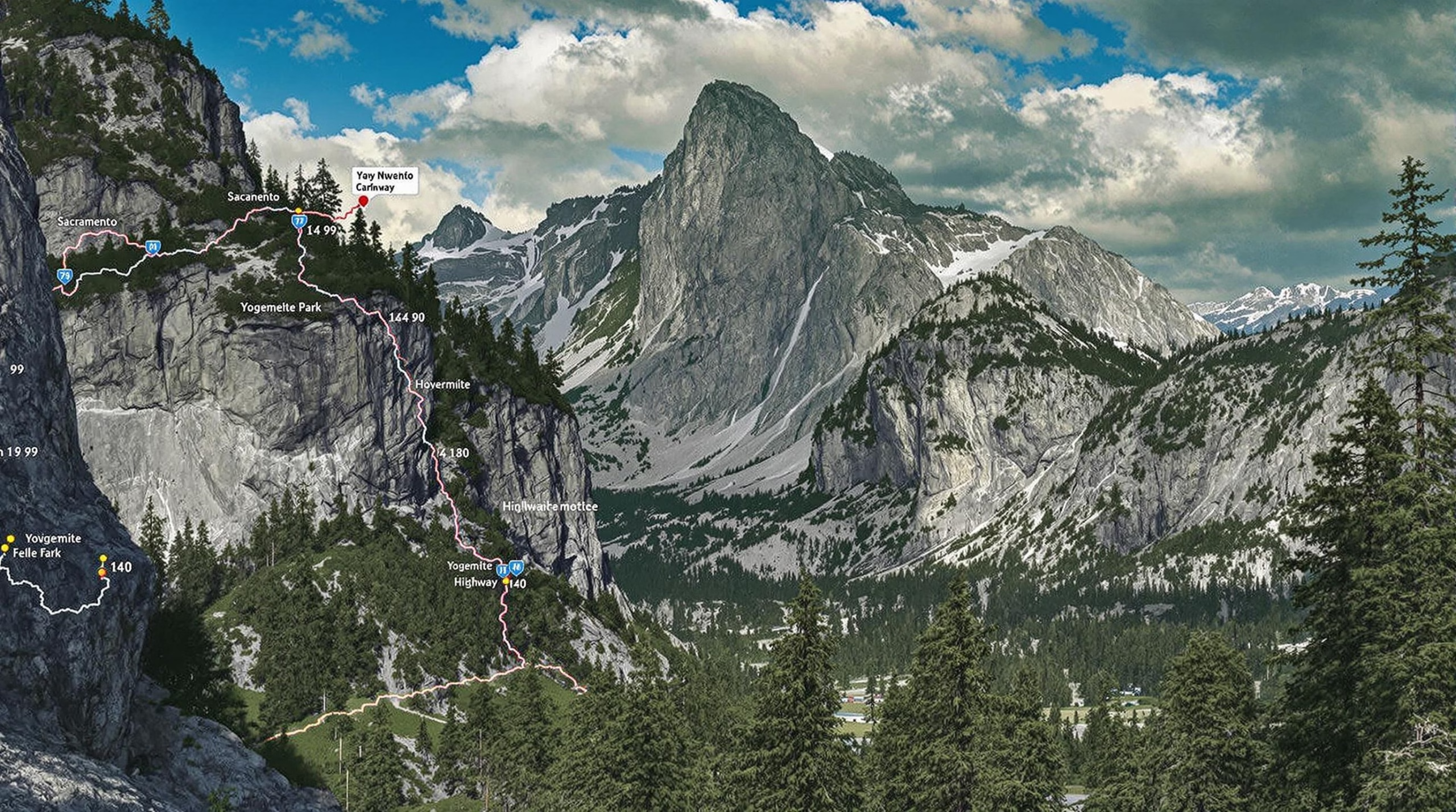
Distance and Route Overview
The direct distance from Sacramento to Yosemite National Park is approximately 140 to 170 miles, depending on the selected entrance and route. The most commonly used entrance for travelers from Sacramento is the Big Oak Flat Entrance near Groveland, though the Arch Rock Entrance near Mariposa is also popular. The drive typically takes between 3.5 to 4.5 hours under normal traffic and road conditions.
The most direct route is via Highway 99 South, transitioning to Highway 120 East through Manteca and Groveland. This route provides a balance of speed and scenic views, making it a preferred option for most drivers.
Primary Route:
- I-5 South or CA-99 South from Sacramento to Manteca
- CA-120 East from Manteca to Groveland
- Continue on CA-120 into Big Oak Flat Entrance of Yosemite National Park
Alternate access routes include:
- CA-140 East from Merced to the Arch Rock Entrance (especially popular when CA-120 is closed due to snow)
- CA-41 North from Fresno to the South Entrance (longer route, but suitable for travelers coming from Southern California)
Estimated Travel Time
Travel time is subject to seasonal conditions, traffic, and roadwork. Under typical conditions:
- Via CA-120 through Groveland: 3.5 to 4.5 hours
- Via CA-140 through Mariposa: 4 to 5 hours
- Via CA-41 through Oakhurst: 4.5 to 5.5 hours
During peak summer months or holiday weekends, expect additional delays due to increased park traffic and entrance wait times.
Key Stopping Points
Along the primary route (CA-120), several towns and landmarks are worth visiting:
- Oakdale: Known as the "Cowboy Capital of the World," ideal for a quick meal or refill.
- Groveland: A charming gateway town with lodging and dining options.
- Jamestown: Offers historic Gold Rush-era attractions and the Railtown 1897 State Historic Park.
These stops not only provide rest opportunities but enrich the overall travel experience.
Parking Information
Once inside Yosemite National Park, parking can be limited, especially during high season (late spring to early fall). Key parking areas include:
- Yosemite Valley Visitor Center
- Curry Village Parking Area
- Trailhead Parking Lots (e.g., for Yosemite Falls, Vernal Fall)
Visitors are encouraged to use the park’s free shuttle system to explore Yosemite Valley, reducing the need to move their vehicles multiple times.
Seasonal Driving Considerations
Winter and early spring travel can be affected by snow and ice, particularly on CA-120 near the Big Oak Flat Entrance. Tire chains may be required, and road closures are common due to weather conditions.
Key seasonal notes:
- Tioga Pass (eastern portion of CA-120) is typically closed from October to late May or early June.
- CA-140 via Mariposa is the most reliable winter route due to its lower elevation and all-weather design.
Travelers should check current road conditions and chain requirements on the Caltrans QuickMap or the National Park Service Yosemite Road Conditions page before departure.
Driving from Sacramento to Yosemite
Driving is one of the most popular transportation options between Sacramento and Yosemite National Park due to its flexibility and convenience. The distance from Sacramento to Yosemite Valley is approximately 140 to 180 miles, depending on the chosen route, and the journey typically takes around 3.5 to 4.5 hours under normal traffic conditions.
Recommended Routes and Distances
- Via CA-99 S and CA-140 E (Merced Route): This route is about 180 miles and is commonly used for its scenic value and access to the western entrance of Yosemite near El Portal.
- Via CA-99 S and CA-120 E (Manteca and Groveland): This route covers around 145 miles and brings travelers through Groveland, a popular stopover town, entering Yosemite from the Big Oak Flat Entrance.
- Via US-50 E and CA-49 S (Scenic Route through Gold Country): Though slightly longer in duration, this route provides a more leisurely drive through historic Gold Rush towns.
Key Stopping Points
- Jamestown and Sonora: Historic Gold Country towns ideal for food, fuel, and sightseeing.
- Groveland: A charming town with lodges and restaurants, located about 24 miles from the Big Oak Flat Entrance.
- Mariposa: Another key stop with dining and lodging options, especially when taking the CA-140 route.
Parking Information
Parking within Yosemite National Park is abundant but fills up quickly during peak seasons. Most major trailheads and visitor centers offer designated parking areas. Arriving early in the day is recommended, especially during summer weekends and holidays.
Seasonal Driving Considerations
- Winter: Snow and ice can impact road conditions, especially on CA-120 and in higher elevations. Chains may be required.
- Spring and Summer: Roads are generally clear, though traffic increases significantly during peak tourist season.
- Fall: Cooler temperatures and lighter crowds make for pleasant driving conditions.
Train Travel Options
Although there is no direct train from Sacramento to Yosemite Valley, travelers can combine Amtrak rail service with regional bus or shuttle connections for a comfortable and scenic trip.
Available Rail Services
- Amtrak San Joaquin Line: Departs from Sacramento and travels south through the Central Valley, with connection points in Merced and Fresno.
Connection Points
- Merced Station: Serves as the primary transfer location for travelers heading to Yosemite via the YARTS (Yosemite Area Regional Transportation System) bus service.
- Fresno Station: Also offers YARTS connections, particularly for southern Yosemite access.
Schedule Information
Amtrak operates multiple daily departures from Sacramento to Merced, with travel time averaging 3 to 3.5 hours including transfers. YARTS schedules vary seasonally, with more frequent service during the summer months.
Cost Considerations
- Amtrak fares from Sacramento to Merced typically range from $20 to $35 depending on time and class.
- YARTS fares from Merced to Yosemite Valley are approximately $14 to $25 one-way, with discounts for seniors, children, and round-trip purchases.
Combined Train-Shuttle Services
YARTS and Amtrak offer coordinated ticketing that includes both train and bus segments. This makes planning simpler and ensures smooth transitions between services.
Bus Transportation
Bus travel offers an affordable and eco-friendly option for reaching Yosemite from Sacramento. While there are no direct public buses into the park from Sacramento, several indirect options are available.
Public Bus Services
- Greyhound and FlixBus: Provide service from Sacramento to Merced or Fresno, where travelers can connect with YARTS buses into Yosemite.
- YARTS: Operates seasonal routes from Merced, Fresno, and other gateway towns into Yosemite National Park.
Private Shuttle Options
Some tour companies and private shuttle providers offer direct transportation from Sacramento to Yosemite, often as part of a day-trip or overnight package. These services typically include hotel pick-up and park admission.
Tour Bus Services
Organized tours from Sacramento to Yosemite are available through various operators. These tours generally include transportation, a guide, and time to explore key sites such as Yosemite Valley, El Capitan, and Bridalveil Fall.
Schedules and Frequencies
Bus schedules vary widely depending on the operator and season. YARTS runs daily during peak season but may reduce frequency during winter. Tour buses often operate on fixed schedules, requiring advance booking.
Cost Comparison
- Public Bus + YARTS combo: Around $30–$50 one way.
- Private shuttle: Can cost $75–$150 per person.
- Tour buses: Typically range from $100 to $200+, depending on inclusions and duration.
Planning Considerations
Best Time to Travel
Late spring through early fall is the most popular time to visit Yosemite due to favorable weather and full access to park facilities. However, this is also when transportation services are busiest.
Seasonal Accessibility
Some routes, including Tioga Pass (CA-120 through the park), are closed in winter due to snow. Always check road status on the National Park Service website before departure.
Booking Requirements
Train and bus tickets should be booked in advance, especially during holidays or summer weekends. Tour packages and private shuttles often require reservations weeks ahead.
Required Permits
While transportation does not require permits, Yosemite National Park may implement reservation systems during peak times. Check the official park website for the latest entry requirements.
Travel Tips
- Start early in the morning to avoid traffic and secure parking.
- Pack snacks, water, and layers – weather can change quickly en route and in the park.
- Consider overnight stays in gateway towns if traveling via public transit to accommodate early or late schedules.
Additional California Travel Resources
Related Destinations
- Lake Tahoe: Easily accessible from Sacramento and offers a contrasting alpine experience.
- Sequoia and Kings Canyon National Parks: Located to the south of Yosemite, these parks can be added to a longer road trip.
Alternative Routes
- Backroads through Gold Country: Add historical value and reduced traffic.
- Highway 88 or 4: Scenic alternatives if heading toward the eastern Sierra.
Regional Transportation Networks
- Sacramento Regional Transit (SacRT): Connects to Amtrak and Greyhound stations.
- YARTS: Key connector for reaching Yosemite without a personal vehicle.
Tourism Information
- California Welcome Centers: Located in Sacramento and other cities along the route.
- Visit California (visitcalifornia.com): Offers travel inspiration and practical tips.
- National Park Service (nps.gov/yose): Provides essential information on park access, conditions, and services.
Travel Planning Essentials
Best Time to Travel
When planning your trip from Sacramento to Yosemite National Park, timing plays a crucial role in your overall experience. The best time to visit Yosemite is typically from late spring through early fall. Between May and October, most of the park’s roads and facilities are open, and weather conditions are favorable for driving and outdoor activities. However, this is also peak season, so expect larger crowds and higher accommodation prices.
If you prefer fewer crowds and don’t mind cooler weather, late fall and early spring offer a quieter experience. Winter travel is possible, but snow and ice can lead to road closures, especially on routes like Highway 120 or the Tioga Pass, which is typically closed from November through May.
Seasonal Accessibility
Yosemite’s accessibility is heavily influenced by the season. In winter, many roads—including Tioga Road and Glacier Point Road—close due to snow. Chains may be required on tires, and delays are common. During spring and early summer, waterfalls are at their most powerful, offering stunning views. Summer provides full access to the park but also brings large crowds. Fall is less busy and still allows access to most areas before snowfall begins.
When planning your route, consider checking the National Park Service website for real-time updates on road closures and park conditions.
Booking Requirements
Accommodation and transportation services to Yosemite can book up months in advance, especially during the high season. It’s recommended to reserve lodging (whether inside or near the park) and any train or shuttle tickets well ahead of your planned travel dates. The same applies to guided tours and campgrounds.
For those entering Yosemite National Park by car, a vehicle entrance fee is required. Additionally, during peak times (such as summer weekends and holidays), Yosemite may require reservations for entry. Be sure to check the park’s reservation policies prior to your visit.
Required Permits
While general park entry can be covered by a standard admission or an America the Beautiful National Parks Pass, certain activities require additional permits. If you're planning to hike popular trails like Half Dome, or camp in the backcountry, you must secure a wilderness permit. These permits are limited and often distributed via a lottery system or on a first-come, first-served basis.
For travelers staying overnight in Yosemite Valley or nearby towns, no special permit is needed beyond your lodging reservation and park entrance fee, unless engaging in restricted activities.
Travel Tips
- Start early: Whether you're driving or taking public transport, beginning your journey early in the day helps avoid traffic and maximizes your time in the park.
- Pack essentials: Due to limited services in some areas of Yosemite, bring water, snacks, and a full tank of gas. Cell service may be limited, so offline maps can be helpful.
- Check weather forecasts: Conditions in the Sierra Nevada can change quickly. Dress in layers and prepare for sudden changes in temperature.
- Respect park rules: Stay on designated trails, follow wildlife safety guidelines, and pack out all trash to help preserve the natural beauty of Yosemite.
Distance and Travel Time Overview
The drive from Sacramento to Yosemite National Park is approximately 140 to 180 miles, depending on the chosen route. The most direct route—via CA-99 S and CA-120 E—takes about 3.5 to 4.5 hours without significant traffic or stops. However, travel time can vary greatly due to weather, road conditions, and seasonal traffic volumes.
If you're combining train or bus travel with shuttle services into the park, total travel time may range from 5 to 7 hours, depending on connections and wait times. Always plan for extra time, especially during weekends or holidays.
Stopover Possibilities
Traveling the approximately 140 to 170 miles from Sacramento to Yosemite National Park—depending on the chosen route—can be a memorable part of the adventure if planned thoughtfully. While a direct drive typically takes between 3.5 to 4.5 hours, adding a stopover allows for rest, exploration, and discovery of California's diverse landscapes and towns. Here are some popular stopover options and what travelers can expect en route.
Popular Gateway Towns
Jamestown and Sonora
Situated along Highway 108, just east of Oakdale, Jamestown and Sonora are historic Gold Country towns that make excellent overnight or lunch break stops. Jamestown is known for Railtown 1897 State Historic Park, while Sonora offers a charming downtown with shops, restaurants, and nearby access to the Sierra Nevada foothills.
Groveland
Located on Highway 120, Groveland is a key gateway to the Big Oak Flat Entrance of Yosemite. With rustic lodging, cafes, and the historic Iron Door Saloon—the oldest continuously operating saloon in California—Groveland is a favorite for travelers looking to stay close to the park without entering it directly.
Mariposa
Accessible via Highway 140, Mariposa is another ideal stopover town offering both historical significance and modern accommodations. The Mariposa Museum & History Center and the charming downtown area provide cultural depth and convenient lodging before the final leg into Yosemite Valley.
Scenic Small Towns and Natural Stopovers
Oakdale
Known as the “Cowboy Capital of the World,” Oakdale sits along Highway 120 and is a convenient place to refuel, grab a meal, or explore its small-town atmosphere. It also features the Oakdale Cheese & Specialties shop—an excellent snack stop.
Columbia State Historic Park
Located near Sonora, Columbia offers a preserved 19th-century town complete with costumed interpreters, gold-panning activities, and horse-drawn carriage rides. It’s a fun and educational detour for families and history buffs alike.
Hetch Hetchy Reservoir
For those entering Yosemite from the northwest, Hetch Hetchy offers a quieter, less-traveled alternative to the main valley. Though it requires a detour, the area provides hiking opportunities and dramatic views without the crowds.
Accommodation Choices Along the Way
Many of the towns mentioned above offer a range of lodging options, from budget motels and chain hotels to boutique inns and rustic lodges. In Groveland and Mariposa, travelers can find everything from cozy bed-and-breakfasts to full-service resorts. Camping is also available in nearby areas such as Stanislaus National Forest or Sierra National Forest for those seeking an outdoor overnight experience.
Strategic Tips for Planning a Stopover
- Departure Timing: Leaving Sacramento in the afternoon and overnighting mid-route allows travelers to arrive at Yosemite early the next morning, taking full advantage of daylight hours in the park.
- Seasonal Considerations: In winter months, certain routes like Highway 120 through the Sierra may be closed or require chains. Always check road conditions and plan stopovers in accessible towns.
- Proximity to Park Entrances: Staying in Groveland or Mariposa positions travelers within an hour’s drive of Yosemite’s Big Oak Flat or Arch Rock entrances, respectively, reducing morning travel times.
Whether it’s for convenience or exploration, incorporating a stopover into your Sacramento to Yosemite journey enhances the overall experience and allows for greater flexibility, especially during peak travel seasons.
Arrival Planning
Best Time to Travel
Timing your arrival at Yosemite National Park is critical for a smooth experience. The best time to travel from Sacramento to Yosemite is typically between late spring and early fall (May through October), when weather conditions are favorable and all park entrances are generally accessible. During these months, Tioga Pass and Glacier Point roads are open, offering scenic routes and fewer travel disruptions.
In winter (November through March), snow and ice can lead to temporary road closures, especially in higher elevations. Highway 120, one of the main routes from Sacramento to Yosemite, may be impacted by closures or require tire chains. Always check the official Yosemite National Park website or call the road conditions hotline before setting out.
Seasonal Accessibility
The route from Sacramento to Yosemite covers approximately 140 to 180 miles depending on your entrance point and preferred route, with an average driving time of 3.5 to 4.5 hours in normal conditions. However, winter weather or heavy summer traffic can extend this considerably. The three main entrances from Sacramento—Big Oak Flat Entrance (Highway 120), Arch Rock Entrance (Highway 140), and South Entrance (Highway 41 via Oakhurst)—offer different levels of accessibility depending on the season.
Highway 140 is generally considered the most reliable year-round access route as it sits at a lower elevation and is less affected by snow closures. This makes it a preferred option during winter months.
Booking Requirements
If you plan to visit between late spring and early fall, especially during peak summer months or holiday weekends, it’s essential to plan ahead. Yosemite National Park often implements a reservation system for vehicle entry during high-traffic periods. These reservations can be made through the official National Park Service website and are required to enter the park by private vehicle during designated times.
Additionally, if you’re staying overnight at Yosemite campgrounds or lodges, reservations should be made months in advance due to high demand. Campsites typically open for booking five months ahead and fill up within minutes during peak seasons.
For those using public transportation or shuttle services, booking tickets early is also recommended, as seats may be limited, especially on weekends and holidays.
Required Permits
Most visitors entering Yosemite for day use by private vehicle do not need a permit outside of the reservation-required dates. However, if you plan to hike in wilderness areas or stay overnight in backcountry campsites, you will need wilderness permits. These permits have limited availability and must be secured in advance through the park’s reservation system.
If your visit includes activities such as rock climbing or group camping, additional permits may be required. Always verify your specific needs with the Yosemite National Park official website.
Travel Tips
- Depart Early: Whether driving or using public transportation, early departure from Sacramento helps avoid traffic and ensures more parking availability upon arrival.
- Pack Essentials: Cell service is limited within Yosemite, so bring printed maps, extra water, snacks, and layers of clothing to accommodate temperature changes.
- Gas Up in Advance: Fuel up before reaching the park boundaries. Gas stations are scarce inside the park and more expensive.
- Use Official Park Apps: Download the NPS Yosemite app for offline maps, trail guides, and alerts, which can be critical in areas with no service.
- Respect Park Rules: Follow Leave No Trace principles, adhere to speed limits, and be mindful of wildlife to ensure a safe and sustainable visit.
By planning your arrival thoughtfully and respecting seasonal and permit requirements, your trip from Sacramento to Yosemite can be both efficient and rewarding.
Whether you’re making a quick day trip or a full Yosemite adventure, the journey from Sacramento is as rewarding as the destination itself. With travel times ranging from 3.5 to 7 hours depending on your method and route, proper planning ensures a smooth and memorable experience. Don’t forget to check road conditions, pack your essentials, and make reservations early. Yosemite’s natural grandeur is waiting—start your journey today!